|

|
Processed through Paypal No account required. |








Buy our over-priced crap to help pay the bills.



|
|
Processed through Paypal No account required. |
| File - Download HookEcho v0.12.0 | ||||||||
| Description | ||||||||
|
A plea... Deanna and I have been running this site since 2008 and lately we're seeing a big increase in users (and cost) but a decline in percentage of users who donate. Our ad-free and junkware-free download site only works if everyone chips in to offset the revenue that ads on other sites bring in. Please donate at the bottom of the page. Every little bit helps. Thank you so much. Sincerely, your Older Geeks: Randy and Deanna Always scroll to the bottom of the page for the main download link. We don't believe in fake/misleading download buttons and tricks. The link is always in the same place. HookEcho v0.12.0 👉 Advanced weather radar, storm tracking and severe weather analysis for your desktop or Android device. HookEcho is a free, open-source NEXRAD weather radar viewer and severe weather analysis program built from scratch in Rust using wgpu and egui. It combines detailed Level 2 and Level 3 radar analysis with national weather information, forecasts, storm tracking, warning intelligence, historical weather replay and tools for storm spotters, weather enthusiasts and storm chasers. Live radar products include reflectivity, velocity, storm-relative velocity and dual-polarization data, with tools for examining multiple elevation tilts, cross-sections, CAPPI altitude slices and 3D radar volumes. HookEcho can detect tornado debris signatures, analyze rotation, track storm cells and display information including hail, storm tops, movement and other severe-weather indicators. National situational-awareness layers include MRMS radar products, precipitation, lightning, hail, rotation tracks, satellite imagery, surface observations, tropical weather and aviation information. Forecast tools include numerical weather models, future radar, severe-weather outlooks, atmospheric parameters and point forecasts. Sounding tools provide Skew-T diagrams, hodographs and severe-weather indices. Warnings are integrated directly into the map. HookEcho displays National Weather Service warning polygons and bulletins, follows storm motion and can monitor saved locations for approaching severe weather. Alerting options include sounds, spoken warnings, desktop and Android notifications, configurable alert rules and optional push notifications. Historical weather can be explored using archived NEXRAD data. Radar, warnings, storm reports, satellite imagery and other available information can be synchronized along the timeline to examine past severe-weather events. Events can also be saved for later replay. HookEcho's interface places the weather map edge to edge with floating controls for searching, layers, alerts and the radar timeline. Multiple panes can display different radar sites, products, tilts, thresholds, layers and map styles simultaneously. A searchable command interface provides quick access to tools and settings. The program also includes features for storm chasing, such as live GPS positioning, chase logs, GPX export, offline map packs, approaching-rain estimates and prefetching of radar data along a chase route. HookEcho can run without its graphical interface for monitoring and automation. Command-line status reports can show current conditions and alerts for saved locations, while its built-in HTTP server can provide weather observations, alerts and rendered radar snapshots to other devices and applications. Home Assistant integration, MQTT publishing and options for desktop widgets and dashboards are also provided. A web version runs in a browser using WebAssembly, and the Android edition uses the same Rust application with a mobile interface designed for phones and tablets. https://hookecho.io/ 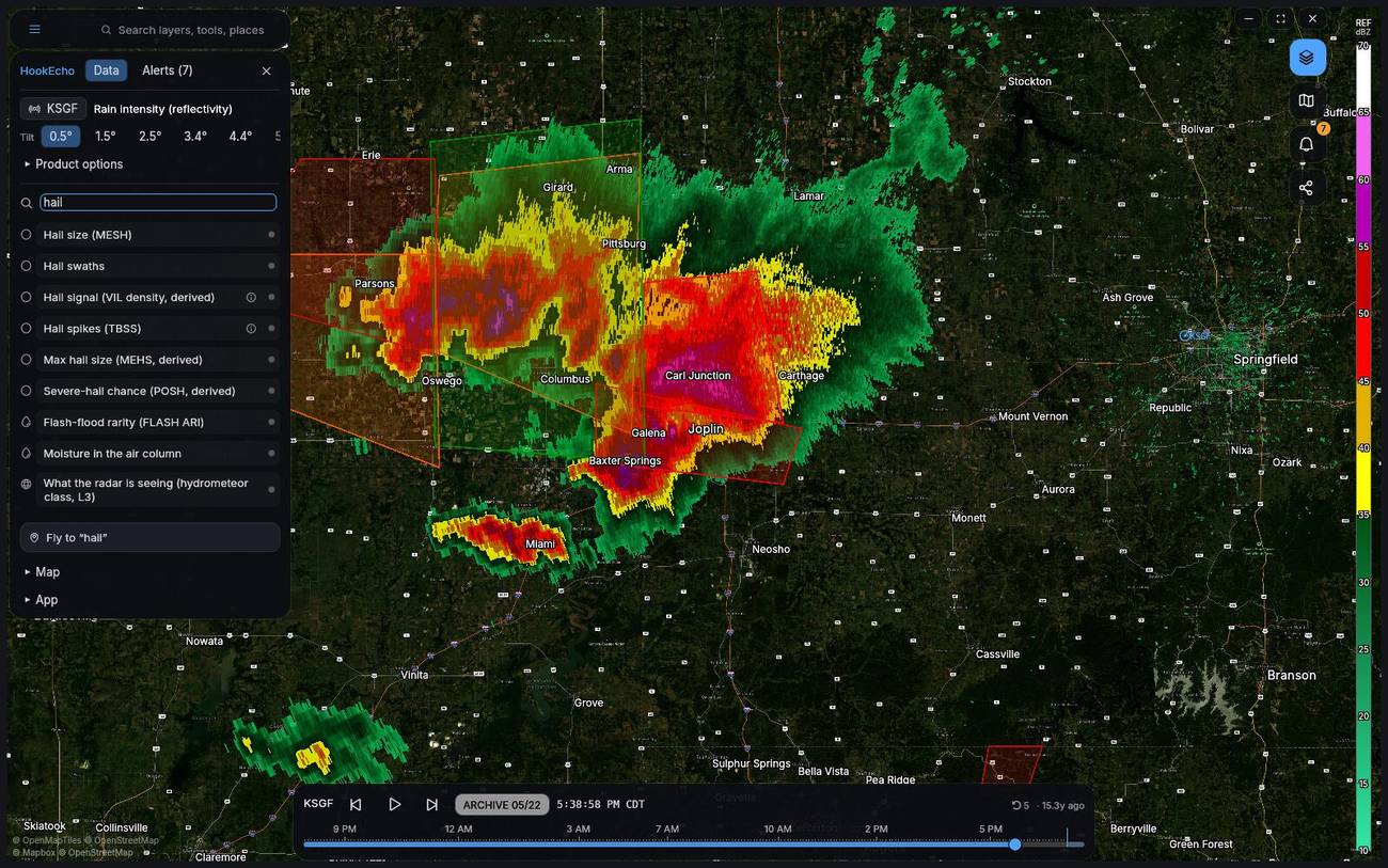 Features: • Displays live NEXRAD Level 2 and Level 3 weather radar • GPU-accelerated radar and map rendering using wgpu • Supports reflectivity, velocity, storm-relative velocity and dual-polarization radar products • Displays multiple radar elevation tilts • Provides multi-pane layouts for viewing different sites, products and tilts simultaneously • Creates vertical storm cross-sections using multiple radar products • Provides CAPPI altitude slices and interactive 3D radar volume views • Includes radar velocity dealiasing for improved rotation analysis • Detects tornado debris signatures using radar data • Provides rotation and azimuthal shear analysis • Detects specialized radar signatures including three-body scatter spikes, ZDR columns and melting-layer bright bands • Provides a gate inspector for examining radar moments at an individual radar gate • Tracks storm cells and ranks them using severity information • Displays hail estimates, storm tops, movement and other storm-cell information • Displays National Weather Service warning polygons and complete warning bulletins • Tracks storm movement and monitors saved locations for approaching weather • Supports configurable weather alert rules • Supports warning sounds, spoken warnings and desktop notifications • Supports optional push notifications • Can attach radar snapshots to alerts • Supports quiet hours and severity thresholds for alerts • Displays live and archived local storm reports • Displays NOAA ProbSevere information • Includes MRMS national multi-radar weather products • Displays MRMS precipitation rate • Displays MRMS rotation tracks • Supports locally accumulated hail swaths • Displays GOES satellite imagery and lightning information • Displays lightning density and can detect lightning jumps for alert rules • Displays precipitation type • Includes accumulated precipitation information • Displays METAR and other supported surface weather observations • Provides wind barbs and aviation flight categories • Displays TAF aviation forecasts • Displays tropical storm and hurricane information • Provides National Hurricane Center advisory and discussion text • Displays SIGMETs, G-AIRMETs and Temporary Flight Restrictions • Provides numerical weather model data and forecast weather layers • Supports HRRR, RAP, GFS, ECMWF, NAM Nest and NBM model information • Displays HRRR future radar forecasts • Provides radar nowcasting with forecast leads extending to 120 minutes • Displays atmospheric instability and severe-weather parameters • Provides forecast and observed atmospheric soundings • Displays Skew-T diagrams and hodographs • Calculates severe-weather and effective-layer sounding parameters • Displays SPC severe-weather outlooks, including Day 4 through Day 8 products • Provides National Weather Service point forecasts by selecting a location on the map • Displays Area Forecast Discussions • Displays Weather Prediction Center surface analysis and fronts • Includes animated HRRR 10-meter wind particles • Provides minute-by-minute rain estimates for selected locations • Replays archived NEXRAD radar data and historical severe-weather events • Synchronizes archived radar with available warnings, reports, outlooks and satellite imagery • Allows weather events to be saved as replay bundles • Supports archive date selection and timeline scrubbing • Includes customizable radar color tables • Supports GRLevelX-compatible placefiles • Supports external scripts and programs as placefile-style plugins • Provides numerous built-in map and satellite backgrounds • Supports different map styles for individual panes • Allows custom XYZ map tile sources • Includes per-layer opacity controls • Provides saved locations for weather monitoring • Includes live GPS storm-chasing mode • Records chase breadcrumb trails with GPX export • Can prefetch radar information along a chase route • Supports offline chase map packs • Provides Android home-screen radar and weather-warning widgets • Provides an Android Quick Settings tile • Supports phone and tablet interfaces • Supports Android haptic feedback and predictive back navigation • Includes battery-saving options for mobile use • Provides an always-on-top mini radar loop on desktop • Includes Streamer/OBS mode for clean radar displays • Provides shareable HookEcho links containing map, radar and timeline information • Supports saved workspaces and pane layouts • Includes accessibility features and colorblind-safe radar palettes • Provides high-contrast and OLED display options • Includes a searchable help center, glossary, keyboard shortcuts and guided tour • Provides command-line weather and warning status reports • Can output command-line status information as text, a single line or JSON • Includes a built-in HTTP server for weather data and radar snapshots • Provides Home Assistant integration • Supports MQTT publishing • Can continuously render radar snapshots for desktop widgets or wallpaper scripts • Includes a browser version built with WebAssembly • Browser edition supports persistent data, GPS, notifications and sharing • Available as Windows installer, MSI and portable ZIP packages • Available for Linux as AppImage and Debian packages • Available as an Android ARM64 APK • Experimental macOS build is also provided by the project Supported operating systems: • Windows 10, Windows 11, 64-bit • Linux 64-bit • Android 10 or Higher, ARM64 • macOS, Experimental Supported languages: English Changes: v0.12.0 08-28-26 • Major interface redesign puts the map edge to edge with floating search, controls and timeline. • Desktop window uses borderless floating controls with an optional decorated-window mode. • Android now uses the same floating interface concept as the desktop, with Material modal sheets on phones and a side rail/drawer on tablets and landscape devices. • Android adds long-press map inspection, one-handed double-tap/drag zooming, pane swiping and haptic feedback. • Android widgets can show the distance to the nearest storm, and a battery-saver mode reduces polling and repaint activity. • Chase mode can prefetch the next radar and replay a chase against archived weather. • First-run setup is simplified to automatically locate the user and select the nearest radar when location access is allowed. • A searchable help hub combines the glossary, hotkeys, guided tour and What's New information. • Weather text products use improved rendered typography on desktop and Android. • GOES satellite loops can follow historical radar archive dates, with additional water-vapor bands available. • MRMS rotation tracks are available as field layers, and hail swaths can accumulate locally over a selected period. • Snow squalls and snow banding receive dedicated winter-weather emphasis. • Alert rules can react to lightning jumps. • NAM Nest and NBM are added to the available weather models. • Synoptic mesonet observations can be used with the user's own API key. • Storm cells are ranked using a composite severity score, and a selected cell can open a centered 3D volume. • Individual panes remember their own thresholds and field layers. • Weather events can be saved as replay bundles with synchronized archived radar, warnings, reports and outlooks. • Web version can be installed as a Progressive Web App and caches its application shell for offline use. • Web version can persist tiles, radar volumes and palettes between visits. • Browser file dialogs, GPS and notifications are supported. • Browser sharing can preserve the radar site, camera and selected time. • Adds MQTT publishing, a Home Assistant camera-loop endpoint and a live dashboard for server mode. • Displays an update indicator when a newer release is available without automatically installing it. • Adds interface motion controls, reduced-motion support and automatic degradation on slower hardware. • Application identifier changed to io.hookecho.HookEcho as part of the HookEcho branding. 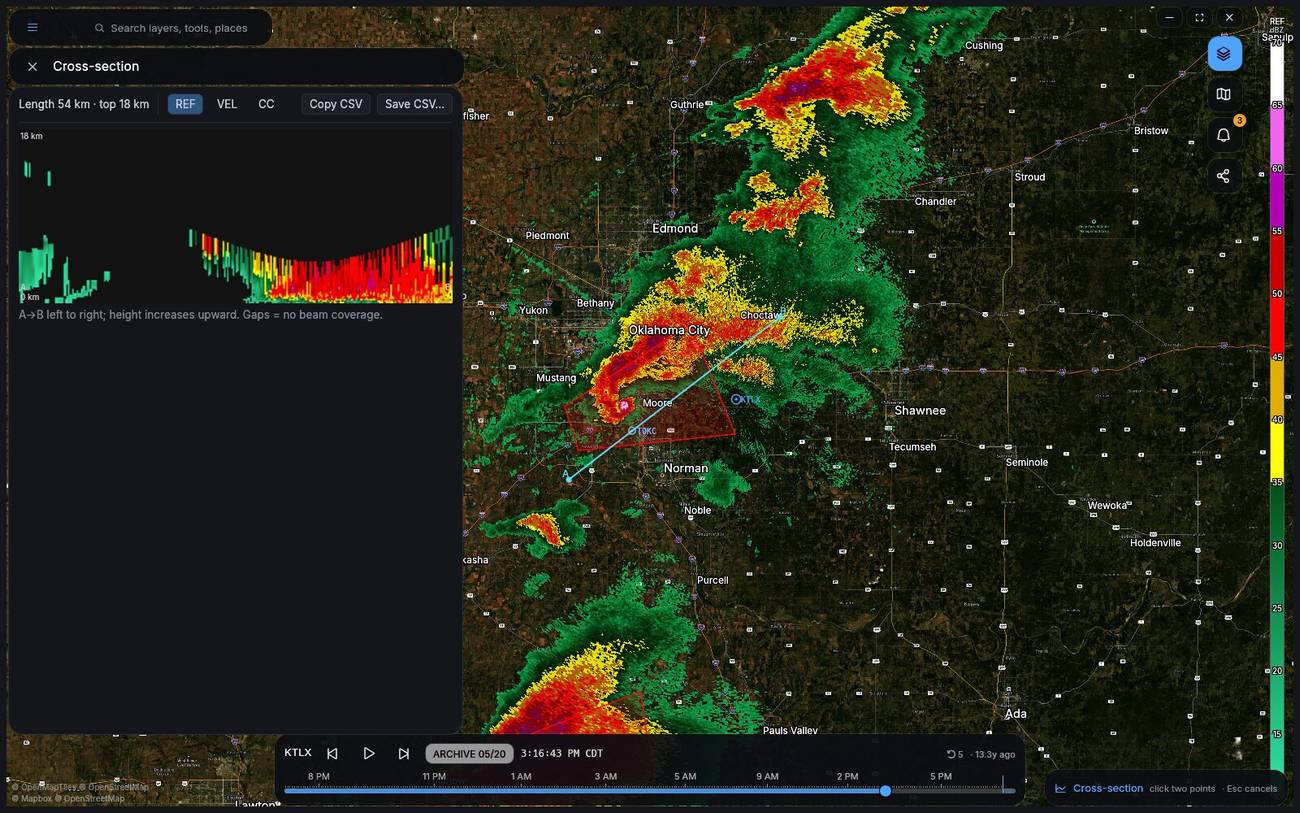 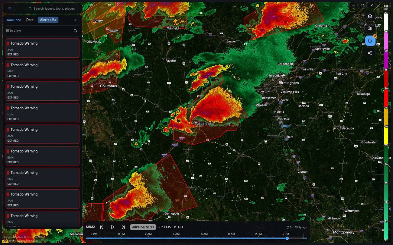 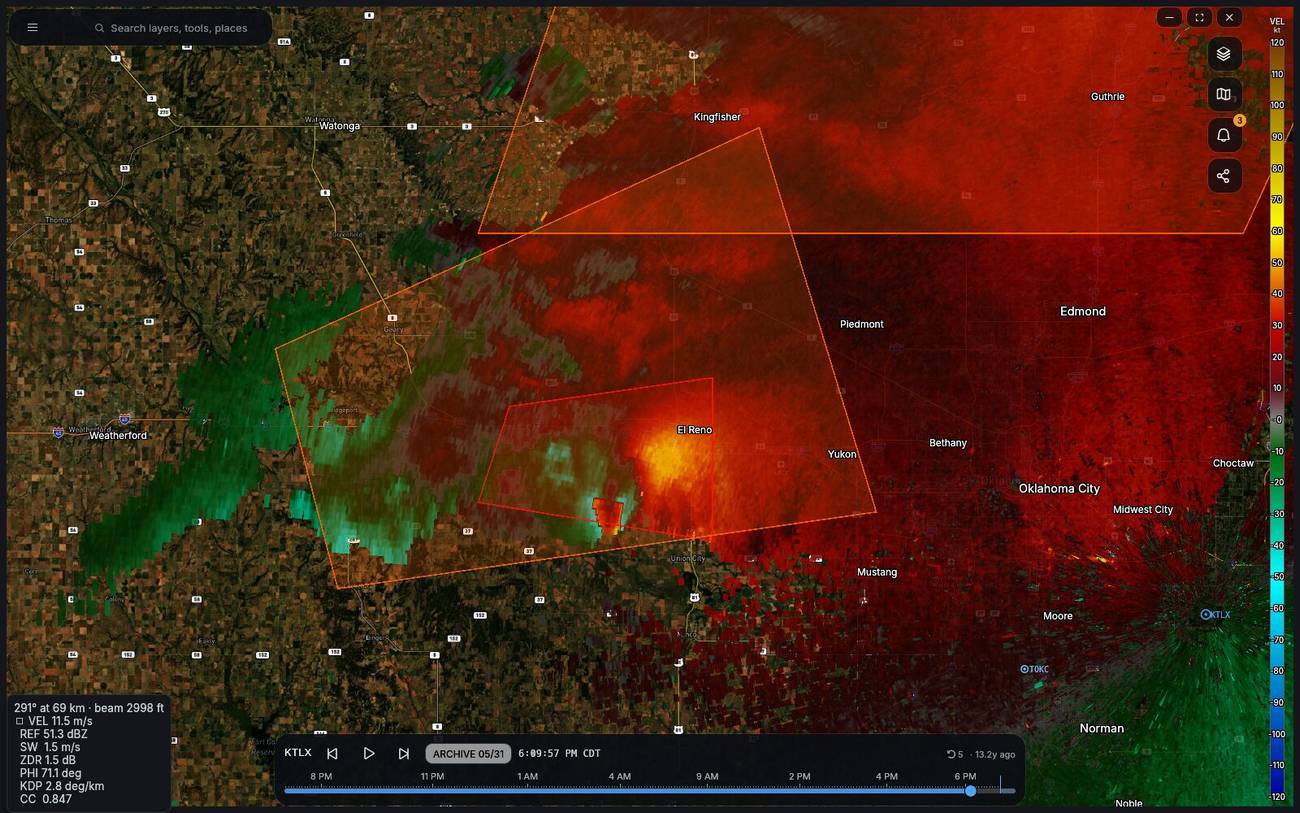 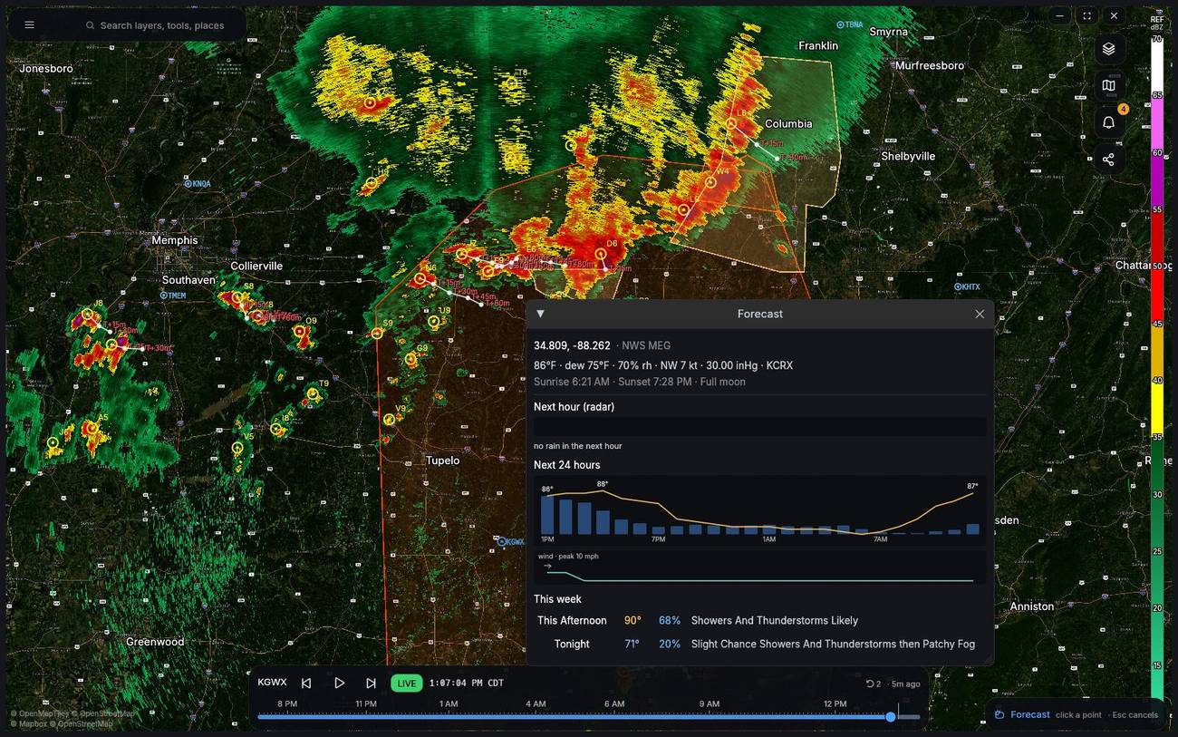 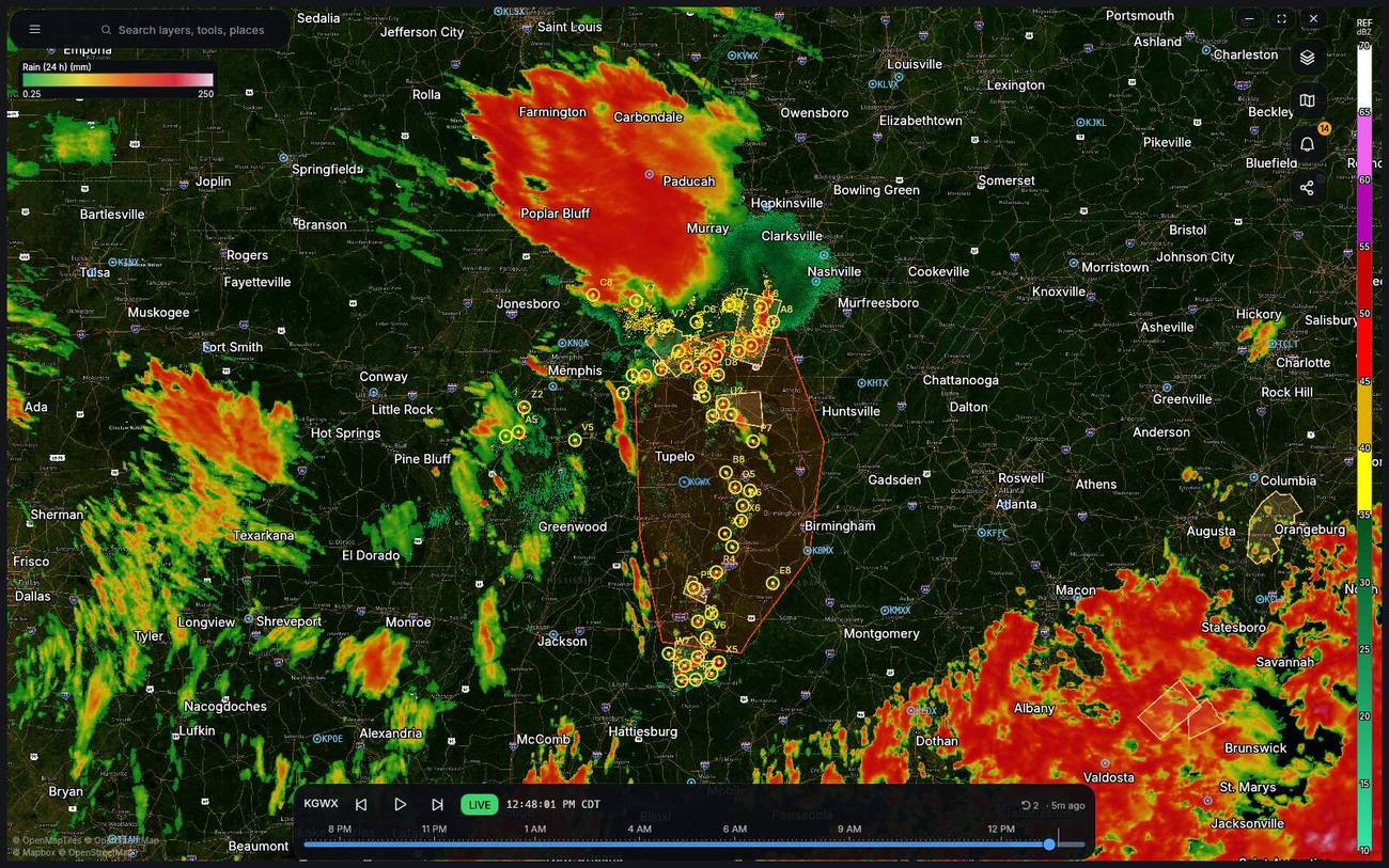 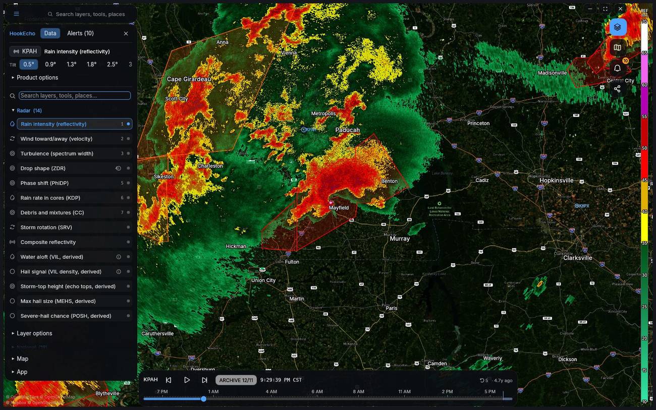 This download is for the Windows 64bit portable version (very bottom of page). All other download assets are below: macOS: HookEcho-macos.zip Linux: HookEcho-x86_64.AppImage Android: HookEcho-arm64-v8a.apk Click here to visit the author's website. Continue below for the main download link. |
||||||||
| Downloads | Views | Developer | Last Update | Version | Size | Type | Rank | |
| 327 | 1,393 | David-d4vid87 | Aug 28, 2026 - 12:43 | 0.12.0 | 13.15MB | ZIP |  , out of 2 Votes. , out of 2 Votes. |
|
| File Tags | ||||||||
| egui hrrr meteorology mrms nexrad radar rust storm-chasing weather wgpu HookEcho | ||||||||
Click to Rate File Share it on Twitter → Tweet
|