|

|
Processed through Paypal No account required. |








Buy our over-priced crap to help pay the bills.



|
|
Processed through Paypal No account required. |
| Files | ||||
| File Name | Rating | Downloads | ||
 |
Google Earth Pro Desktop (Direct Installers) v7.3.7 Google Earth Pro Desktop (Direct Installers) v7.3.7 👉 Explore the world with high-resolution satellite imagery, 3D terrain, and professional mapping tools. Google Earth Pro Desktop lets you explore virtually any location on Earth using detailed satellite imagery, 3D buildings, terrain, Street View, and historical imagery. The Pro edition includes advanced features for GIS professionals, educators, businesses, and enthusiasts, such as importing and exporting GIS data, creating maps, measuring distances and areas, recording HD tours, printing high-resolution images, and working with KML/KMZ files. These direct installers are ideal for offline deployment, managed environments, or systems where the standard installer or automatic updates are not suitable. Google Earth Pro is free to use and available for Windows, macOS, and Linux. Features: • Explore high-resolution satellite imagery and detailed 3D terrain • View 3D buildings and landmarks around the world • Access historical imagery to compare changes over time • Import and export GIS data • Create, edit, and share KML and KMZ files • Measure distances, areas, and elevation profiles • Record HD flyover tours with Movie Maker • Print high-resolution maps and images • Use Street View for ground-level exploration • Search for addresses, businesses, and geographic coordinates • Add placemarks, paths, polygons, and image overlays • Supports GPS data import and geographic visualization • Save and organize custom places and projects Supported operating systems: • Windows 7 (32-bit and 64-bit), Windows 8, Windows 8.1, Windows 10, Windows 11 • macOS • Linux Debian/Ubuntu 64-bit, Fedora 64-bit, openSUSE 64-bit Supported languages: English, Arabic, Bulgarian, Chinese (Simplified), Chinese (Traditional), Croatian, Czech, Danish, Dutch, Finnish, French, German, Greek, Hebrew, Hindi, Hungarian, Indonesian, Italian, Japanese, Korean, Norwegian, Polish, Portuguese (Brazil), Portuguese (Portugal), Romanian, Russian, Serbian, Slovak, Slovenian, Spanish, Swedish, Thai, Turkish, Ukrainian, Vietnamese Changes: v7.3.7 03-03-26 Google Earth 10 KML compatibility improvements Support for gx:CascadingStyle KML extension Support for additional Google Earth 10 KML extensions Fixed app launch issue on some recent Linux releases Measurement tool and property editor now use the same ... |
 |
481 | Jul 10, 2026 Google LLC 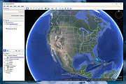 |
|
SAGA GIS v9.2.0 SAGA GIS v9.2.0 A Geographic Information System (GIS) software with immense capabilities for geodata processing and analysis. SAGA is programmed in the object oriented C++ language and supports the implementation of new functions with a very effective Application Programming Interface (API). Functions are organised as modules in framework independent Module Libraries and can be accessed via SAGA’s Graphical User Interface (GUI) or various scripting environments (shell scripts, Python, R, ...). SAGA's first objective is to give (geo-)scientists an effective but easy learnable platform for the implementation of geoscientific methods. This is achieved by SAGA's unique Application Programming Interface (API). The second is to make these methods accessible in a user friendly way, what is first of all done by its Graphical User Interface (GUI). Together this results in SAGA's true strength: a fast growing set of geoscientifc methods ready to be used in numerous applications. SAGA is coded in the widespread and powerful C++ programming language and has an object oriented system design. Since version 2 SAGA uses the cross platform GUI library wxWidgets for user interface functionality. Because wxWidgets enables operating system independent software development, you can run SAGA with MS-Windows as well as with Linux. Features Object oriented system design (C++) Modular structure allows framework independent function development SAGA API with immense support for geodata handling GUI for intuitive data management, analysis and visualization Runs on Linux as well as on Windows operating systems Portable software running without installation even from memory sticks (MSW) Free and Open Source Software (FOSS) Scripting via command line, Python, Java, R Far more than 450 freely available functions for geodata analysis Georeferencing and ... |
|
2,732 | Nov 21, 2023 SAGA Development Team 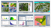 |
| Showing rows 1 to 2 of 2 | Showing Page 1 of 1 | 1 |
OlderGeeks.com Copyright (c) 2026
