Buy our over-priced crap to help keep things running.


| File - Download Arnis v2.1.1 | ||||||||
| Description | ||||||||
|
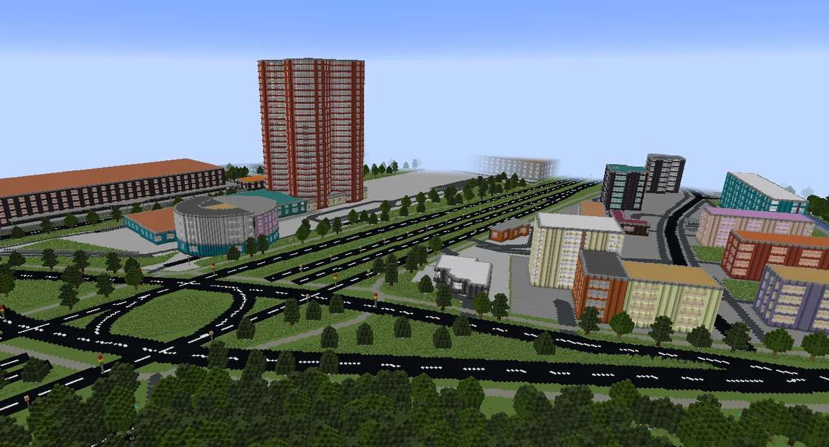
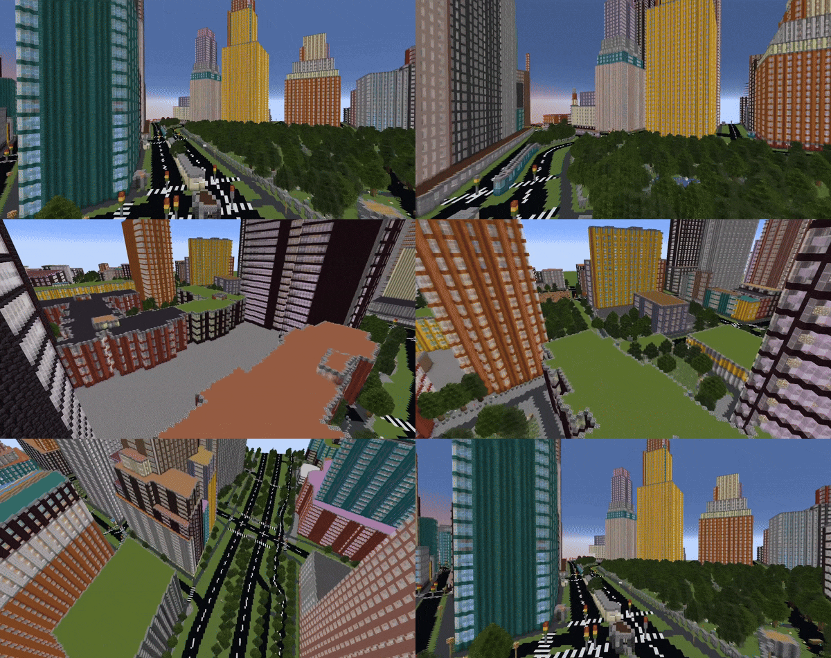
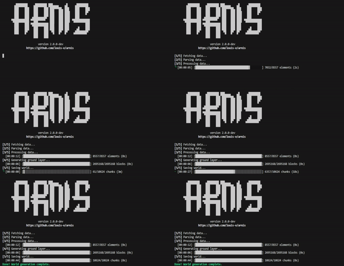
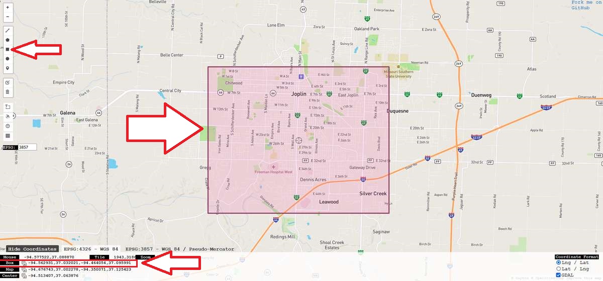
A plea... Deanna and I have been running this site since 2008 and lately we're seeing a big increase in users (and cost) but a decline in percentage of users who donate. Our ad-free and junkware-free download site only works if everyone chips in to offset the revenue that ads on other sites bring in. Please donate at the bottom of the page. Every little bit helps. Thank you so much. Sincerely, your Older Geeks: Randy and Deanna Always scroll to the bottom of the page for the main download link. We don't believe in fake/misleading download buttons and tricks. The link is always in the same place. Arnis v2.1.1 Generate cities from real life in Minecraft. This open source project written in Rust generates any chosen location from the real world in Minecraft Java Edition with a high level of detail.  By leveraging geospatial data from OpenStreetMap and utilizing the powerful capabilities of Rust, Arnis provides an efficient and robust solution for creating complex and accurate Minecraft worlds that reflect real-world geography and architecture. Arnis is designed to handle large-scale data and generate rich, immersive environments that bring real-world cities, landmarks, and natural features into the Minecraft universe. Whether you're looking to replicate your hometown, explore urban environments, or simply build something unique and realistic, Arnis offers a comprehensive toolset to achieve your vision.  How it works  The raw data obtained from the API (see FAQ below) includes each element (buildings, walls, fountains, farmlands, etc.) with its respective corner coordinates (nodes) and descriptive tags. When you run Arnis, the following steps are performed automatically to generate a Minecraft world: Processing Pipeline 1) Fetch Data from Overpass API: The script retrieves geospatial data for the desired bounding box from the Overpass API. You can specify the bounding box coordinates using the --bbox parameter. 2) Parse Raw Data: The raw data is parsed to extract essential information like nodes, ways, and relations. Nodes are converted into Minecraft coordinates, and relations are handled similarly to ways, ensuring all relevant elements are processed correctly. 3) Prioritize and Sort Elements: The elements (nodes, ways, relations) are sorted by priority to establish a layering system, which ensures that certain types of elements (e.g., entrances and buildings) are generated in the correct order to avoid conflicts and overlapping structures. 4) Generate Minecraft World: The Minecraft world is generated using a series of element processors (generate_buildings, generate_highways, generate_landuse, etc.) that interpret the tags and nodes of each element to place the appropriate blocks in the Minecraft world. These processors handle the logic for creating 3D structures, roads, natural formations, and more, as specified by the processed data. 5) Generate Ground Layer: A ground layer is generated based on the provided scale factors to provide a base for the entire Minecraft world. This step ensures all areas have an appropriate foundation (e.g., grass and dirt layers). 6) Save the Minecraft World: All the modified chunks are saved back to the Minecraft region files. Usage Run: arnis.exe --path="C:/YOUR_PATH/.minecraft/saves/worldname" --bbox="min_lng,min_lat,max_lng,max_lat" How to find your bbox coordinates Use bboxfinder.com to draw a rectangle of your wanted area. Then copy the four box coordinates as shown below and use them as the input for the --bbox parameter.  The world will always be generated starting from the coordinates 0 0 0. Try starting with a small area since large areas take a lot of computing power and time to process. Manually generate a new Minecraft world (preferably a flat world) before running the script. The --bbox parameter specifies the bounding box coordinates in the format: min_lng,min_lat,max_lng,max_lat. Use --path to specify the location of the Minecraft world. FAQ • Wasn't this written in Python before? Yes! Arnis was initially developed in Python, which benefited from Python's open-source friendliness and ease of readability. This is why we strive for clear, well-documented code in the Rust port of this project to find the right balance. I decided to port the project to Rust to learn more about it and push the algorithm's performance further. We were nearing the limits of optimization in Python, and Rust's capabilities allow for even better performance and efficiency. The old Python implementation is still available in the python-legacy branch. • Where does the data come from? The geographic data is sourced from OpenStreetMap (OSM)1, a free, collaborative mapping project that serves as an open-source alternative to commercial mapping services. The data is accessed via the Overpass API, which queries OSM's database. • How does the Minecraft world generation work? The script uses the fastnbt cargo package to interact with Minecraft's world format. This library allows Arnis to manipulate Minecraft region files, enabling the generation of real-world locations. • Where does the name come from? The project is named after the smallest city in Germany, Arnis2. The city's small size made it an ideal test case for developing and debugging the algorithm efficiently. Changes: v2.1.1 Added settings menu including scale option and custom bbox input by @louis-e in #91 Force dark theme by @louis-e in #92 Added winter mode by @louis-e in #93 Check session lock before selecting world by @louis-e in #94 Add floodfill timeout support by @louis-e in #95 Added support for generating new world by @louis-e in #98 Added groundlevel parameter to settings by @louis-e in #100 Click here to visit the author's website. Continue below for the main download link. |
||||||||
| Downloads | Views | Developer | Last Update | Version | Size | Type | Rank | |
| 368 | 3,425 | Louis Erbkamm <img src="https://www.oldergeeks.com/downloads/gallery/thumbs/Arnis4_th.png"border="0"> | Jan 03, 2025 - 13:32 | 2.1.1 | 15.55MB | EXE |  , out of 13 Votes. , out of 13 Votes. |
|
| File Tags | ||||||||
| Arnis v2.1.1 | ||||||||
Click to Rate File Share it on Twitter → Tweet
|